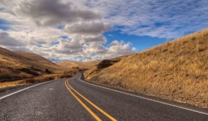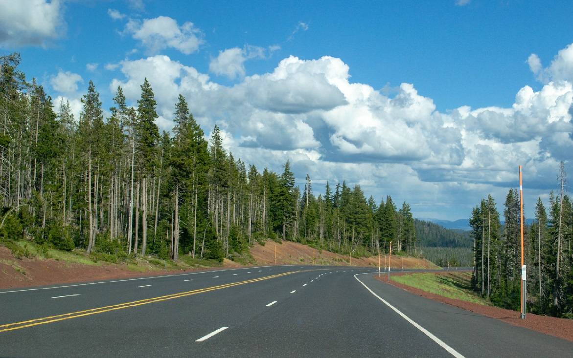
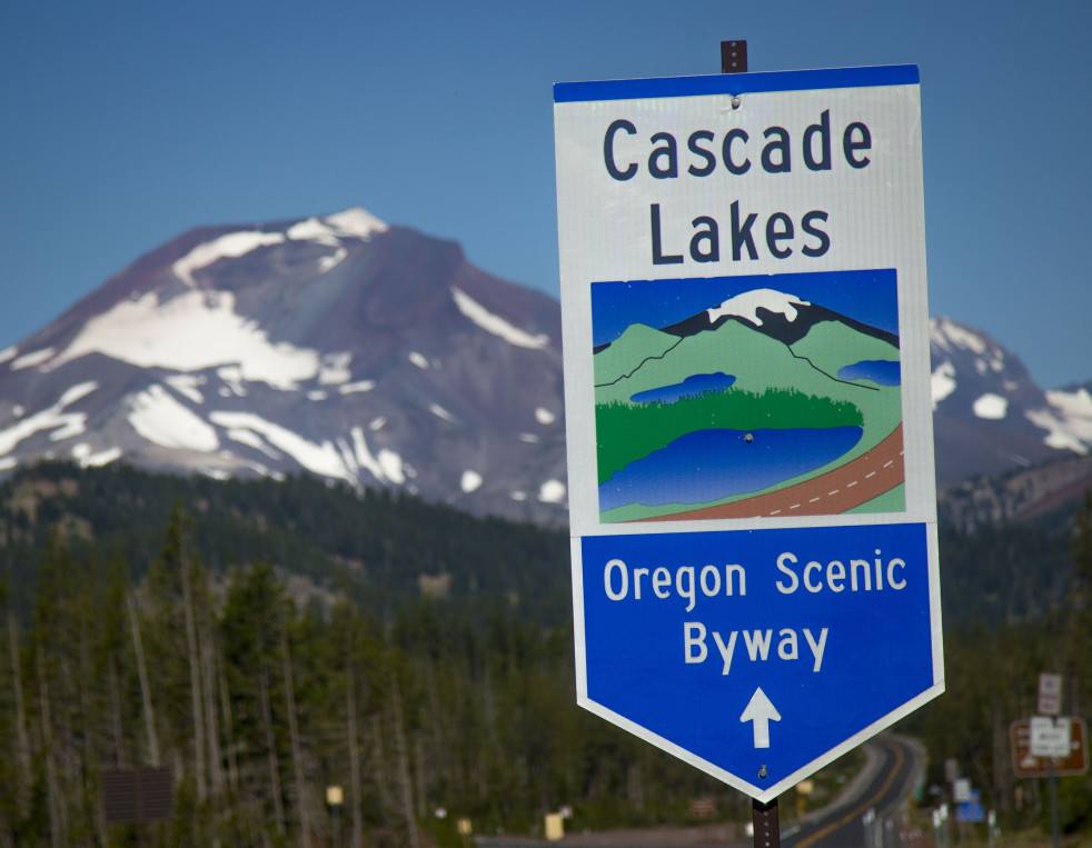
The Cascade Lakes Highway – Oregon State Highway 46 – is surrounded by mountains, lakes, and forests that have delighted motorists, bicyclists, and hikers for over fifty years. Formerly known as Century Drive, the route offers a fun and interesting day-long excursion during your summer and fall. It is an official U.S. Forest Service National Scenic Byway.
Because of heavy snowfall in the winter and early spring, the route is closed past the entrance to Mt. Bachelor parking lot from mid-November until late May every year. However, the designation of the Cascade Lakes Highway as one of the nationally-recognized Scenic Byways proves that the natural beauty to be seen from June through October is well worth the day spent driving and stopping along the circuit.
The designation of Cascade Lakes Highway as one of the nationally-recognized Scenic Byways proves that the natural beauty to be seen from June through October is well worth the day spent driving and stopping along the circuit
The geographical setting of Central Oregon is unique in many ways, with the snow-covered volcanic peaks of the Cascade Mountain Range providing a beautiful scenic background This range acts as a physical barrier to the moist air from the Pacific Ocean, creating a much drier climate than parts of Oregon west of the Cascades. Take some time to observe the trees surrounding you as you drive along the route. You’ll notice distinct changes in the forest appearance. The changes are due to the age and type of trees and growing conditions such as slope, soil, moisture and elevation. Young ponderosa pine trees are mixed through stands of lodgepole pine, mixed coniferous forest and older ponderosa pine. Lodgepole pine is one of the most aggressive and hearty of western forest trees. It is easily recognized because of its long, slender stem and short, narrow, open crown. This pine was named because Indians made use of it to build their lodges or wickiups.
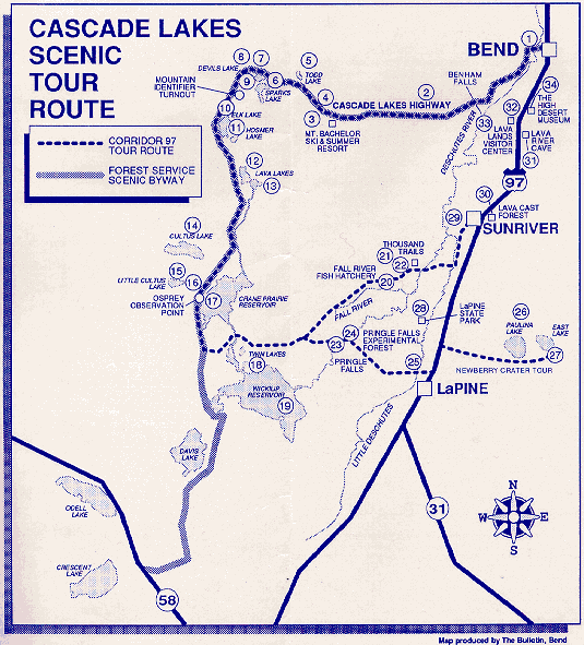
This route involves two tours. The Corridor 97 Association’s Cascade Lakes Tour is one of several tour routes exploring areas off of Highway 97. The Forest Service has designated a portion of the same route as a National Scenic Byway. They call it the Cascade Lakes Scenic Byway. The map shows the exact route of each tour. The Corridor 97’s route has three entry points off of Highway 97. They are the northern entry which is in Bend, the central entry at Sunriver and the southern entry at LaPine There is also a southern leg of the tour that explores Newberry Crater. Beginning at the entry points, directional signs are placed on both sides of the roads along the route. Just look for the blue and white Corridor 97 logo.
History
As you travel along the tour route, you will be crossing paths made by some of the first explorers of the Northwest, including trapper Nathaniel J Wyeth and explorers John C. Fremont and Kit Carson. The horse trails and wagon roads that use to wind through the area were first replaced by a main wagon road from Bend to Sparks Lake and the Elk Lake country in 1920. Segments of other roads in the area were joined to this original road soon after to create the circuit that became known as Century Drive because it was approximately 100 miles long. Present day road “improvements” have shortened the route to approximately 87 miles.
Northern Entry Point: Bend
Named Farewell Bend, the community was founded by Alexander Drake in 1900. Its name came from the Farewell Bend Ranch, which was used as a campsite for early travelers. In 1905, the “Farewell” was dropped by postal authorities and Bend was incorporated as a city. Railroads came in 1911, and lumber mills established in 1915 gave the community the stability with which to grow. Always known as a fine summer recreation area, with the development of Mount Bachelor Ski Resort, tourism gradually became Bend’s second largest industry and established Bend as a year-round vacation destination. The city of Bend, noted for its friendly, hospitable people and wonderful quality of life, has a population of 18,900 within the city limits and approximately 40,000 for the Bend urban area.
Amenities: shopping/lodging/restaurants/gas/ rental services
Central Entry Point: Sunriver
“Camp Canoe” was the name early trappers gave the Sunriver area. Easy access to the Deschutes River and the surrounding “Great Meadows” made the area an ideal place to camp. Kit Carson scouted for General Fremont’s expedition into the Oregon Territory and both camped in the Sunriver area. By the late 1800s, settlement in the Sunriver area was large enough to warrant a schoolhouse stage stop and a hotel. The school and hotel were located near the present day site of Sunriver Lodge. During World War II, the location was used as an army engineering camp called Camp Abbot, which accommodated ten thousand men.
Today, Sunriver is a 3,300-acre residential/ resort community. Bordering the Deschutes for almost five miles makes for ideal fishing and boating. Its climate is characterized by low annual rainfall, low relative humidity moderate days and cool nights. Golf, tennis, bike riding, horseback riding, and hiking are just a few of the many recreational activities available in the Sunriver area.
Amenities: grocery store/gas/lodge/restaurants/rental houses/condo’s/shopping
Activities: golfing/ fishing/canoeing/ picnicking/hiking/bike riding/tennis/ nordic skiing/horseback riding
Southern Entry Point: La Pine
The southern leg of the tour route begins just three miles north of LaPine. Within five miles of the core area of downtown LaPine, there are 17,000 families, many of whose homes can be seen on the last few miles of the route. The area has a high population of retired citizens who have selected the area because of its year-round recreation. LaPine is at 4,300 feet in elevation. There are 50 lakes within a 50-mile radius of LaPine, two alpine skiing mountains within 39 miles, and hundreds of cross-country ski trails, with more being added each year. A 4th of July celebration, amateur rodeo activities and Last Frontier Days offer plenty of activities for all ages. Junior rodeo season in the LaPine area starts in May and continues throughout the summer.
Amenities: store/gas/lodging/restaurants
Activities: fishing/canoeing/hiking/nordic skiing
The Stops
Below is a list of the 35 best sights along the highway.
1 Drake Park in Bend
The northern leg of the tour begins in Bend at Highway 97 and Franklin Avenue intersection Downtown Bend is located in the area of Wall and Bond Streets which intersect with Franklin Avenue. Visitors are encouraged to park in Mirror Pond Parking Lot (just west of the Franklin and Wall intersection) and explore the charming downtown area. Franklin Avenue turns into Riverside Blvd as your tour winds around beautiful Drake Park. The original site of Bend was selected around this area because it was an easy location for early travelers to cross the Deschutes River.
2 Swampy Lakes
Fifteen miles west of Bend on the Cascade Lakes Highway are hiking, mountain biking and cross-country skiing opportunities at the Swampy Lakes area. From the trailhead at the north end of the parking lot, skiers or hikers can enjoy a variety of marked trails from 2 to 10 miles in length The area provides five shelters that are usually stocked with wood in the winter. On the other side of the Cascade Lakes Highway in the same general area are snowmobile trails. Sno-Park permits are required for both areas in the winter. The elevation of this area is about 5,600 feet.
3 Mt. Bachelor Ski and Summer Resort
Known for the best skiing in the Pacific Northwest, Mt. Bachelor boasts of ten chairlifts, including the Summit Lift which takes you all the way to the top of the 9,000-foot mountain for a breathtaking 360-degree view, along with great skiing challenges. From Memorial Day through Labor Day, the Summit Lift is open to foot passengers to ride the lift both ways or ride to the top and hike down. Along with 3,100 vertical feet of skiing, Mt Bachelor also offers four day lodges, restaurants, lounges, shops and a Nordic center with nearly 60 km of machine-groomed trails. Sno-Park permits are not required at Mt Bachelor’s parking lots.
4 Dutchman Flat
Just west of the entrance to Mt Bachelor, a whole new scenic landscape beckons. By some quirk of nature, the small pumice desert, called Dutchman Flat, has not accumulated enough soil nutrients to sustain the growth of many plants. Pussypaws with pink blooms and sulfur flowers with yellow blooms are a few of the hearty plants that grow in this unique area.
5 Todd Lake
A short walk from the parking area,’ this picturesque small lake is just the place for the visitor looking for a secluded tent camping area without the noise of traffic and motors.
Amenities: campsites (no drinking water).
Activities: hiking/swimming/picnicking/fishing (no motors )
6 Sparks Lake
This lake offers an excellent lesson in geology. All lakes are destined for a short life in the geological timescale. Eventually, lakes become filled with sediment or drained by erosion and gradually transformed into meadows. Sparks Lake is an excellent example of a lake slowly changing from a lake to marsh, to meadow or forest, depending on the final acts of erosion, fire or use by people.
Activities: fishing (fly-fishing only; motors allowed, up to 10 mph)
7 Green Lakes Trailhead
This is one of several access points into the 242,000 acres Three Sisters Wilderness. This wilderness has 111 lakes and miles of trails to search for solitude. Located on the North Sister is Collier Glacier, which is the largest glacier in Oregon. Abundant wildlife can be seen along the trails. Deer, many small animals and a large variety of birds are common inhabitants of the area The Golden-Mantled Ground Squirrel and the noisy Clark’s Nutcracker will probably be the most conspicuous wildlife.
8 Devils Garden
West of Green Lakes Trailhead is a small scenic area with several springs surfacing from the edge of a huge lava flow and creating a little meadow. Along with the lush meadow grass, you’ll find moss, blue lupines and the Indian paintbrush. Legends tell of a Warm Springs Indian man that convinced a Klamath Indian woman to return north with him. Later he and the warriors accompanying him, were ambushed at this pass by a group of Klamath warriors who were led by a jealous rival.
A sample of the rock from the Devils Hill flow now rests on the moon as a monument to the astronaut training at the lava lands of Central Oregon, which was held in 1964 and 1966 for the Apollo missions James Irwin, who later took the rock to the moon, and other astronauts spent time in the area preparing for their voyage.
9 Devils Lake
This small, shallow lake is a nice area for a quiet picnic with a beautiful view of the mountains.
Amenities: camp sites (no drinking water)
Activities: hiking/fishing
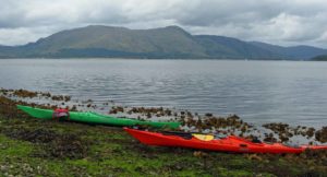
10 Elk Lake
In the summer, this lake is known for attracting many windsurfers and sailboats, creating a beautiful scene with Mt. Bachelor and the South Sister in the background. Most windsurfing activity takes place at Sunset Cove, located on the east side of Elk Lake. In the winter people visit the lake via cross-country skis, snowmobiles or a snow cat belonging to Elk Lake Lodge. The lodge is in operation year-round with the exception of a short period of time between seasons.
Amenities: camp sites/cabins/lodge/restaurant/ grocery store/gas/trailhead
Activities: hiking/swimming/picnicking/boating (motors allowed – 10 mph)/fishing/windsurfing/sailing/nordic skiing/snowmobiling
Rentals: canoes/paddle boats/row boats/fishing boats & motors
11 Hosmer Lake
This lake is set aside as a special sports fishermen lake. It is the only western lake stocked with Atlantic Salmon. Fishing is limited to fly fishing with a barbless hook, catch and release. The lake creates a beautiful scene with grassy meadows that border the lake and a view of Mt Bachelor.
Amenities: camp sites
Activities: boating/fishing
12 Lava Lake
Picturesque is the best way to describe this lake with its lodge and grassy picnic area. This is one of our many lakes that is well known for its good fishing.
Amenities: camp sites/rv sites/lodge/grocery store / gas
Activities: boating/fishing (motors allowed – 10 mph)/ fishing
Rentals: canoes/paddle boats/row boats/fishing/ boats & motors/fishing equipment
13 Little Lava Lake
Fed by springs under the lake, Little Lava Lake is the headwater of the Deschutes River.
Amenities: general camping area without designated sites
Activities: boating/fishing (motors allowed – 10 mph)
14 Cultus Lake
The mixture of trees in this area offers a contrast to the rest of the route. Here you’ll find ponderosa pine, douglas fir, white fir, white pine, sugar pine and spruce along the road into the lake area. This is one of the few places along the route where you’ll find shallow sandy beaches.
Amenities: camp sites/cabins/lodge/restaurant/ grocery store/gas/trailhead
Activities: hiking/swimming/picnicking/boating/windsurfing/sailing/water skiing /fishing
Rentals: canoes/row boats/kayaks/fishing boa& motors
15 Little Cultus Lake
Located south of Cultus Lake with Cultus Mountain between the two, Little Cultus is much smaller and more secluded.
Amenities: camp sites (no drinking water)
Activities: hiking/swimming/boating/fishing (motors allowed – 10 mph)
16 Osprey Observation Point
Crane Prairie Reservoir is an artificial lake impounding waters for farm irrigation purposes. Constructed in 1929, it has become an outstanding fishing area and a breeding ground for the Osprey (fish hawk), identified as an endangered species in 1969. Osprey are active at Crane Prairie and surrounding lakes and streams during their migratory stay (May to October). From the parking lot a short walk takes you to an observation area on the west side of the reservoir. Here you can view snags and artificial nesting poles inhabited by the birds. Many visitors enjoy watching Osprey dive for fish from more than a hundred feet above the water. Cormorants, terns, a variety of ducks and bald eagles are also likely to be present.
17 Crane Prairie Reservoir
Another view of Crane Prairie Reservoir can be seen on this side trip to the east shore, where commercial services are available.
Amenities: camp sites/rv sites/lodge/grocery store/ gas
Activities: boating/fishing (motors allowed 10 mph)/ hiking/picnicking /swimming
Rentals: fishing boats & motors
18 South Twin Lake
Both North and South Twin Lakes are considered by geologists to be classic examples of volcanic maars (craters). Both are symmetrical in shape, have no defined inlets or outlets, and are about 60 feet deep. North Twin has tent sites, but no drinking water or facilities. South Twin has a cabin named after President Hoover, who stayed there on a fishing trip in 1940. The information listed below refers to South Twin.
Amenities: camp sites/cabins/lodge/restaurant/grocery store/showers & laundry facilities (both open to the public)
Activities: swimming/picnicking/boating/fishing (no motors)
Rentals: paddle boats/row boats
19 Wickiup Reservoir
Wickiup Reservoir was named for the “wickiup” poles left standing from year to year by the Indians who camped in the area while fishing and hunting. They would make shelters out of the poles which were covered by brush, tree limbs, etc. When the area was flooded over in 1949 to provide irrigation water, these poles were still present.
Amenities: camp sites
Activities: boating/fishing/waterskiing
Rentals: row boats/fishing boats & motors (both obtained from South Twin Lake Lodge – across the road)
20 Fall River Fish Hatchery
A truly beautiful spot in Central Oregon it is operated by the Oregon Department of Fish and Wildlife as part of the statewide fish propagation program and produces some 140,000 legal size rainbow trout annually, in addition to many thousands of smaller fish for stocking Oregon’s angling waters. Several thousand visitors come to the hatchery each year to view both the fish production activities and enjoy the beautiful setting.
21 Deschutes River/Big River Campground
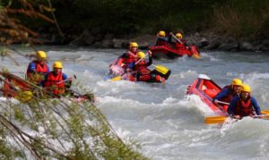
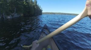
A favorite sport is to float the Deschutes River from below Pringle Falls to just above Benham Falls, north of Sunriver Resort. Although the distance by air is only about 29 miles, the winding river distance is nearly double. The river was named by fur traders of the Hudson Bay Company as Riviere des Chutes (which means a river of falls). It has often been described as resembling a tree with nearly all of its branches on one side. Due to the lava underneath it acting as a giant sponge, the Deschutes River maintains a remarkably even flow. With its headwater at Little Lava Lake, it is fed by thousands of springs as it winds its way across the state. It eventually drops to a point of 150 feet above sea level as it reaches the Columbia River, one hundred and forty miles to the north. Historically, its main use has been for irrigation, as is also the case at the present time. It also plays an important role in providing such things as fish and wildlife habitat, and recreation in the form of fishing, whitewater rafting, tranquil float trips, swimming, etc., as well as providing scenic beauty to the area.
Also near this location is Thousand Trails Resort which is a membership recreational vehicle resort featuring a western set used in movies.
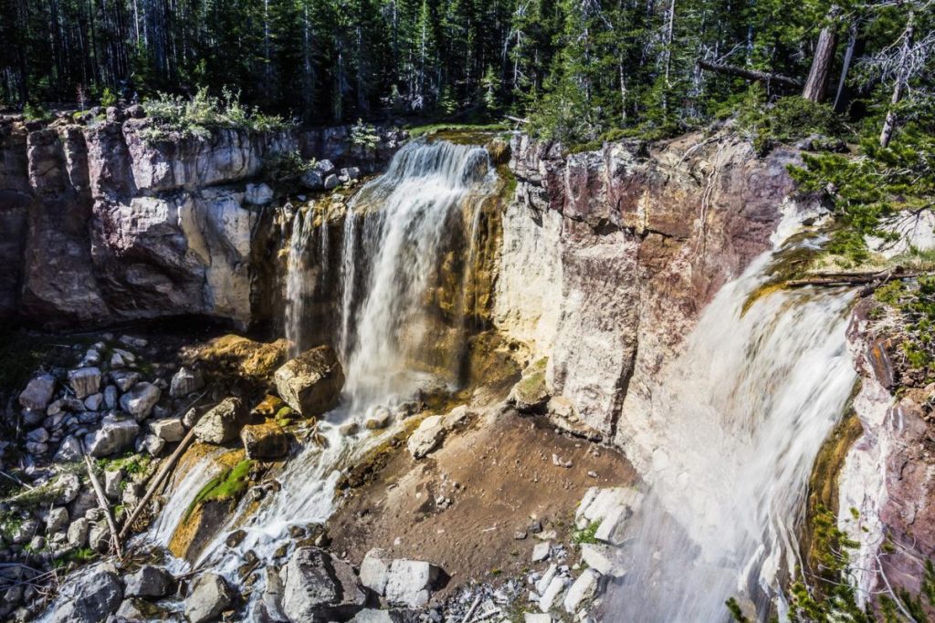
23 Pringle Falls
Good fishing and camping spots are located on both sides of the river to the south. The area also offers plenty of opportunities to drift the river, canoe, fish and watch the Osprey as they nest and fish the river. Deer can be observed drinking from the cold, clear waters of the river.
24 Pringle Falls Experimental Forest
You’ll notice numbers on the trees. This is an experimental stand that helps the Forest Service to gauge the effects of natural forest life on some of the most remarkable trees in the Northwest. The numbers help researchers compile complete records on the ecosystem.
25 Little Deschutes River
This meandering river travels about 120 river miles to cover approximately 30 land miles from its origin to its confluence with the Deschutes River near Sunriver. There is a lot of inner tubing and fishing in this tributary to the Deschutes. It takes a rafter about four hours to cover a four-mile stretch of this beautiful stream.
Newberry Crater Tour
Another tour route designated by the Corridor 97 Association, is located off of Highway 97, six miles north of LaPine, or 8 miles south of the Sunriver turn-off. Follow signs on Forest Service Road 21, thirteen miles east of Highway 97.
Newberry Volcano is the largest ice age volcano in Oregon, encompassing 500 square miles. Several enormous violent eruptions in the past have formed this five mile wide caldera called Newberry Crater. Within this crater lie two scenic lakes a lava flow of black glass (obsidian)— Paulina Falls and Paulina Peak. In the winter, the road into this area is only plowed for the first ten miles to the Sno-Park lot (permits required).
26 Paulina Lake
Located in Newberry Crater. At one time. Paulina and East Lakes were connected, making a single large lake. The depth back then may have been 1,500 to 2,000 feet. Eruptions eventually split them into two separate lakes. Paulina was named after the Paiute Indian Chief Paulina, who used this area as hunting grounds. This lake covers 1,500 acres and is about 240 feet deep at an elevation of 6,331 feet. Also near this lake is Chief Paulina Horse Camp for those who bring their horses to ride the trails. Open year round.
- Amenities: camp sites/cabins/lodge/restaurant, grocery store/gas
- Activities: hiking, swimming, picnicking, boating, fishing, windsurfing, sailing, Nordic skiing, snowmobiling
- Rentals: canoes, rowboats, fishing boats & motors, fishing equipment
27 East Lake
Located in Newberry Crater. There were no fish in either Paulina or East Lakes when adventurer Peter Ogden first saw them in 1826. Since then, careful stocking has turned them into two of Oregon’s favorite fishing lakes. East Lake is known for its record-breaking German Brown Trout and Eastern Brook. The Teeny Nymph lure was developed at East Lake and evolved out of Jim Teeny’s desire to catch the “big one.” The 8,000 foot Paulina Peak looms in the background, offering a spectacular view to those wishing to hike to the top.
Amenities: campsites/cabins/lodge, restaurant/grocery store
Activities: hiking, swimming, picnicking, boating, fishing
Rentals: fishing boats & motors
Other attractions are available that are located along or near Highway 97 between Bend and LaPine They are all worth seeing and we hope you take time to explore them.
28 La Pine State Recreation Area
Many rafters and canoeists enjoy floating the Deschutes. A popular section is the eight miles from Pringle Falls to LaPine State Park, with only one short portage around the Tetherow Log Jam (2 1/2 miles below Pringle Falls). From the park which is a state campground, to Sunriver, 16 miles downstream, floaters can enjoy a leisurely ride as the river flows about two miles per hour and passes through forests and meadows. Here wildlife can be enjoyed with peace and solitude along inaccessible stretches.
Amenities: tent sites, RV sites
Activities: hiking, picnicking, boating, fishing
29 Sunriver Nature Center
Located in Sunriver, the Nature Center offers live animal displays, classes, a botanical garden, and observatory. Hours subject to change. Admission charged. Drive west of Lake Aspen on River Road, toward the Sunriver marina and airport.
30 Lava Cast Forest
Located across from the central entry point of the tour routes, this area boasts one of the finest collections of tree molds in the western hemisphere. These casts were formed as molten lava flowed through a virgin forest about 6,000 years ago. A one mile, paved loop trail wanders through the lava flow and shows examples of tree molds or lava casts. Nine miles east on Forest Road 9720.
31 Lava River Cave
Just south of The High Desert Museum is the longest known uncollasped lava tube in Oregon. Self-guided brochures and lanterns are available near the parking lot. A trail is an easy one hour (1.2 mile) trip. The temperature is a constant 40 degrees, so you’ll need a jacket. Services closed in winter months. Admission charge.
32 Lava Lands Visitor Center and Lava Butte
Lava Butte is an extinct volcanic cone with a paved road to the top providing an outstanding view of the Cascades Lava Lands Visitor Center, located at the base of the butte, offers automated displays and slide shows describing the history of the area’s volcanic past. Three interpretive trails around the crater extend from 1/4 mile to 1/2 mile. Naturalist on duty. Open daily: May – October. No admission fee.
33 Benham Falls
Follow ‘Deschutes River Views’ signs to the end of the road from Lava Lands Visitor Center. Park at the picnic area and walk across the bridge and on the trail 1/2 mile downstream to view the spectacular scene of untamed rapids. This area is actually misnamed as it features rapids, not falls. Movies featuring this area include The Indian Fighter, Rooster Cogburn, and Up the Creek.
34 High Desert Museum
An indoor/ outdoor museum of local, cultural and natural history of our area. Features graphic and living displays and activities’ including reconstructions of historic and prehistoric dwellings, living animal exhibits native to the area, forestry exhibits stream/pond hate tats and nature trails. Also features the new Earl A. Chiles Center on the Spirit of the West, which features a walk through time beginning with the Native Americans, on through the cowboy days of the 1800’s. Admission fee; open year-round.