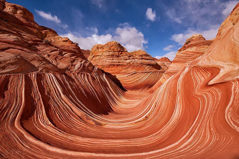
It’s the photos of “The Wave” that catch your attention. Swirls of colors created in sandstone.
The Wave is a rock formation on the Utah-Arizona border in the Paria Canyon-Vermilion Cliffs Wilderness. It’s a place few see because of its remote location and because of a permit system limiting the number of visitors to just 20 a day. Many of the visitors are not Americans, they are Europeans who have seen the pictures and want to see this unusual place for themselves.
For those who win a permit in the online (apply here) or in person lottery, the next challenge is getting to the trailhead. The Wire Pass trailhead is about halfway between Page (AZ), and Kanab (UT). It’s down an 8.3 mile bumpy, dirt road that sometimes has deep ruts and washboard sections. During dry times, a 2 wheel drive car can make it down the road, but when it’s wet, the road can be impassable. The day the Father of my college roommate went, the road was in such bad shape, he was the only one who made it through and that was because he hired a guide who knew how to get around the bad spots.
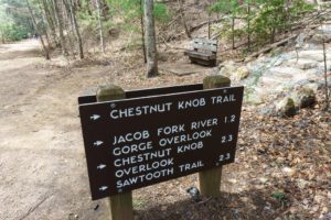
The trailhead has information signs, a register for hikers going to Wire Pass/Buckskin Gulch and a bathroom. There’s a small campground nearby which is really just a place a place to park, there are no amenities.
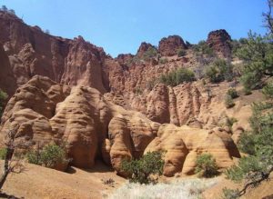
The Wave is like an ocean wave that just seems to flow in this spot. It flows left to right, up and down, from one side to another and up the surrounding rocks.
Starting the Hike
To start the hike, you cross the road and head into the wash. You’ll quickly come to a fence, then back into the wash. Hikers going to The Wave should look for the sign for Coyote Buttes, that takes them up on an old road. This steep hill leads to a register. Even though you already have a permit, sign the register.
From here, hikers trudge through the soft sand to “the Notch,” then the hike gets fun and challenging. Wave hikers get specific instructions with photos when they get their permit. The directions aren’t the best, but they do work. As hikers follow the slick rock and the photos, the area becomes a bit of puzzle. You’ll quickly find yourself asking: Do I go to the right of that formation or a different one? We found it was kinda fun to determine which butte/teepee/formation was which in our photo directions. There are occasional cairns, but only occasional.
The Wave is just below a slot/grey canyon in the distance, well above a wash. As you hike through soft sandy sections, you’ll see numerous tracks. Thanks to the photo directions, you can see where you need to go, it’s just a matter of choosing which path looks best to you.
One piece of advice: Don’t come in the heat of the summer. Even on a 60-degree day in April, we found it quite hot hiking over the sandstone as it reflects the sun.
One last push/hike through soft sand ends right at the Wave formation. You come around a corner and wow, you find this colorful, incredible alley between four rock formations.
The Wave is like an ocean wave that just seems to flow in this spot. It flows left to right, up and down, from one side to another and up the sides of the surrounding rocks. While it’s not a big area, it is a photographer’s paradise. You’ll want to take pictures from the bottom, the top and from each of the sides. Don’t stand in one place, take pictures from lots of different angles and spots. Take close-ups, take wide shots. Take a picture, then take a step to your right and take another. Keep doing it. Bring an extra memory card and extra batteries, you do not want to run out of photo space or power here.
Bring lunch. At some point, you’ll need to trade off this spot with others. Pick a spot a bit higher up, eat lunch and take more photos when the light changes.
Sadly, people will stand right in the middle of the Wave while you’re trying to take photos, you will need to negotiate to share time here. Fortunately, on the day we were here, some people came early and left. Others arrived after 1pm, but we still had people who stood in he middle of the best area for hours! Yes, hours. We finally had to ask them to move and share. Some flat out ignored our requests. I thought they didn’t understand English, but they were wearing ipods and couldn’t hear us until we stood directly in front of them and talked.
As you eat lunch, try to come up with the words to describe this place. Does it remind you of gooey taffy? Or maybe the colorful tall slides at the fair that kids slide down on a burlap bag? Is it a wave made or oranges, reds and yellows instead of ocean blues? While it made be hard to put into words, you’ll definitely agree it is a unique place.
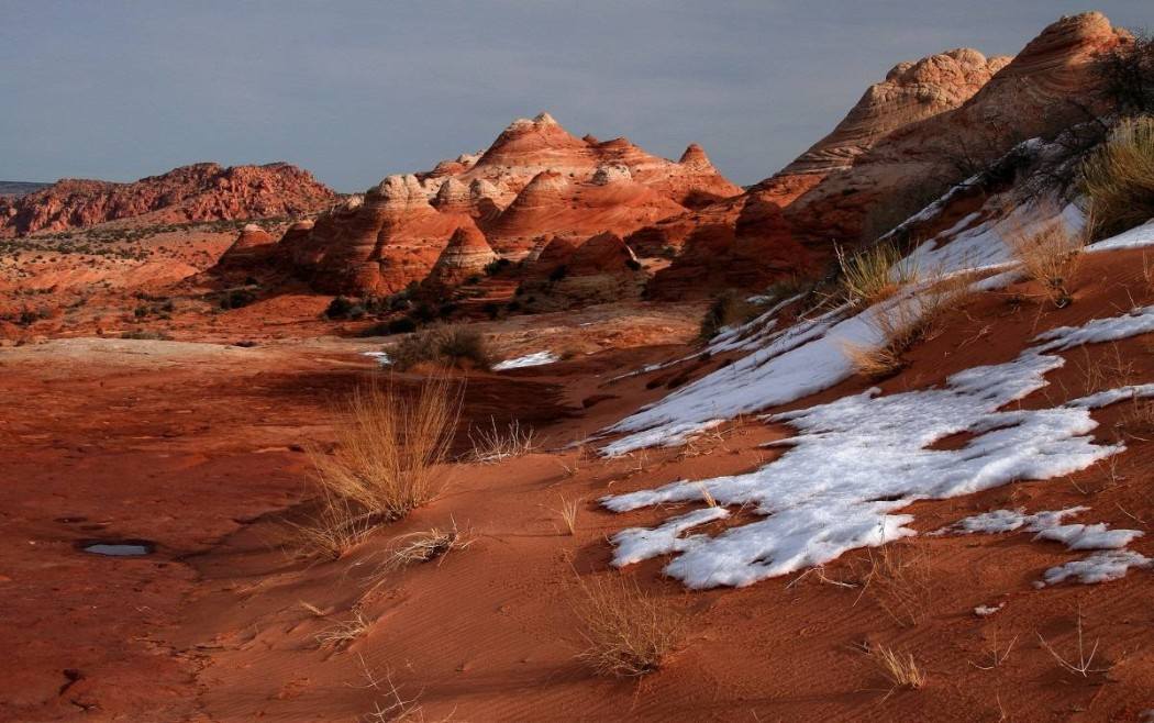
Since you hiked 3 pretty tough miles to get here, spend some time exploring. About 1/3 of a mile Southwest and 100 feet higher is a formation some call the Wave 2. Climb above the first wave toward an arch and then go southwest. You’ll find more colorful lines. The Wave 2 is not as striking as the first wave, but it is interesting. Hike a little further, just see what you can see.
When you return to the first wave, hike in the other direction. Some people hike behind the arch for different views. You may also want to search for what some are calling the Dinosaur Dance Floor.
After all your explorations, return to the Wave to see it in a different light. At midday, you’ll find no shadows, in the morning and late afternoon, you’ll get different pictures. In this world of digital cameras, take lots and lots of pictures, you can always delete some when you get home. Make sure you take some time to appreciate this very unique place that many do not get to see, just because their number isn’t chosen in a lottery.