Walk among Nevadas own Atlantis-a ghost town that was underwater over 60 yrs
Near: Overton, NV
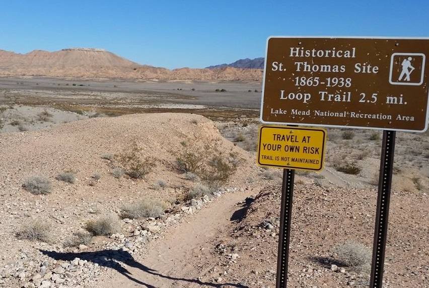
Distance: 3 miles round trip
Elevation Gain: 100 ft
Hike Time: 1.5 hours
Difficulty: Moderate
Trail Condition: OK, but a few difficult spots
Hike Type: Out and Back
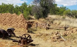
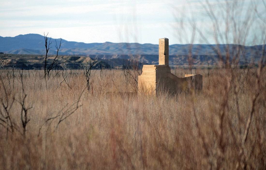
St. Thomas has emerged from the depths of Lake Mead due to the decreasing water level, which is caused by the severe multi-year drought we are experiencing in the southwest. One of the few bright spots to appear from our critical water shortage, St. Thomas had been underwater for 65 years since Hoover Dam was completed, and Lake Mead was created.
St. Thomas was settled by Mormons in 1865, abandoned, then re-settled in 1880. The 1930 U.S. Census listed St. Thomas’ population at 274. This small agricultural community never had electricity or running water but was a tight-knit group, whose inhabitants mostly relocated to Logandale-Overton when the water covered their town. There is much information available about St. Thomas on the internet, and in local publications.
The trail is being rapidly improved. It’s a dangerous proposition to wear short pants or sleeves since the tamarisks are dense and brutal on bare skin.
Trailhead
St. Thomas is located 76 miles NE of Las Vegas.
Take I-15 North 48 miles to Logandale-Overton exit (Nevada Route 169).
Turn South and travel 29 miles to Valley of Fire Road (the State Park enters to your right) — do NOT turn towards Valley of Fire State Park. Instead, turn on the dirt road entering SR 169 on the opposite side of Valley of Fire.
Follow the dirt road to it’s end — St. Thomas Point. There is a portable toilet, and a volunteer ranger lives on-site in a trailer. There are signs leading you to the town of St. Thomas; which is visible from the parking area.
Do not wander off the trail or you can easily get stuck in the mucky sediment that used to be underwater. Dress appropriately for walking in mud, sand & water. You can also reach St. Thomas via Northshore Road (scenic route & fee area). THE VIRGIN & MUDDY RIVERS (they merge at St. Thomas) (Lat:36.46918 Lon:-114.38394)