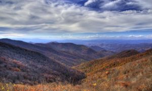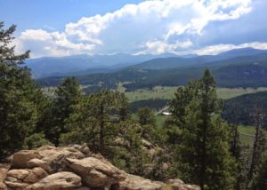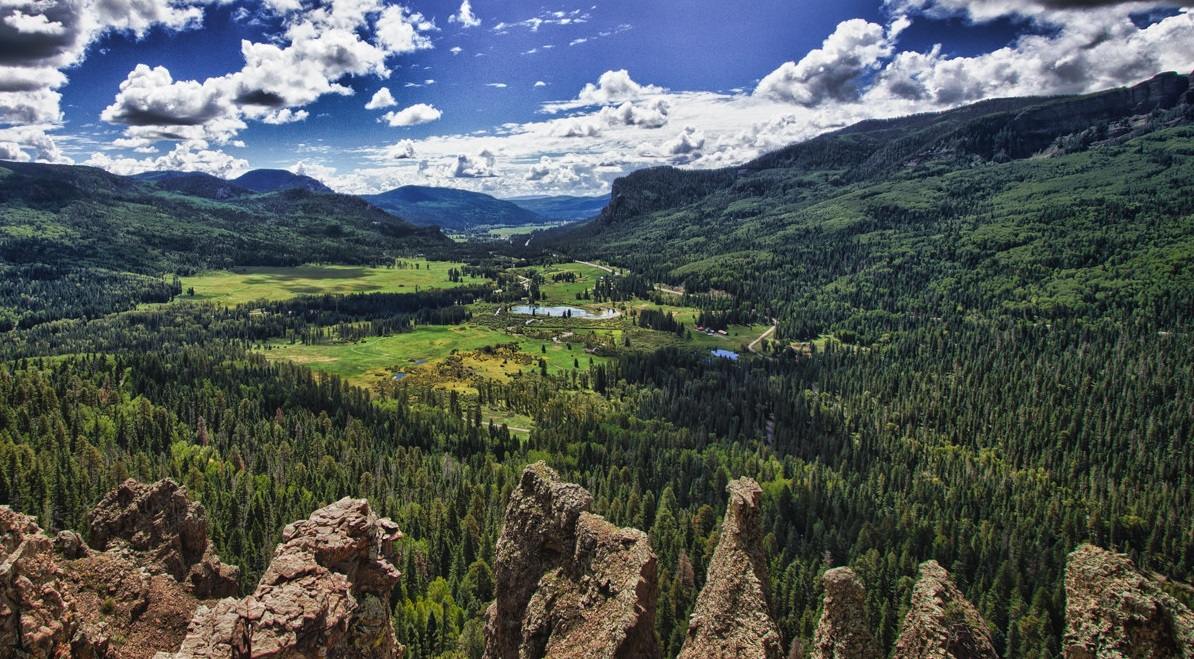
The immaculate 14,000-foot jagged summits of the Sangre de Cristo (Blood of Christ) and the San Juan Mountains dominate the horizon in southwestern Colorado. Hikers and rock climbers can explore an intricate labyrinth of canyons straddled by sheer walls of welded volcanic tuff. Mountain bikers can explore a web of old logging and mining roads that snake their way through the forest along rock ledges carved into volcanic basalt cliffs. Fisherman can pull feisty trout and voracious pike out of secluded alpine lakes.
Table of Contents
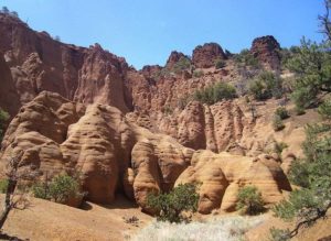
The casual meanderer can wander through alpine meadows skirted by vast stands of Engelmann spruce, aspen, and fir. The geologically curious can marvel at the strange, otherworldly moonscape in the Wheeler Geologic Area where medieval spires are eroded from volcanic tuff.
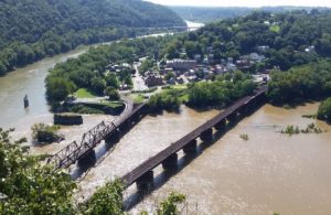
The forest is named for the mighty Rio Grande del Norte, or Great River of the North, as the early Spanish and Indian inhabitants of the Southwest called it. It is the third-longest river in the U.S. and its headwaters are found here in the Rocky Mountains of south-central Colorado before the slow-moving river carves its way for 2,000-miles along a shifting course to the Gulf of Mexico.
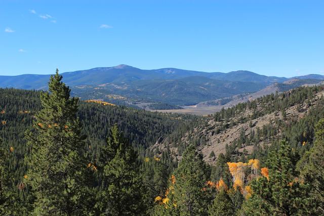
The forest encompasses nearly 2 million acres along the eastern slopes of the Continental Divide.
Hike the Continental Divide
For a challenging hike, try the 17-mile segment of the Continental Divide Trail that links Knife Edge to Sawtooth Mountain. Most of this rocky trail is well-above timberline as it hugs the backbone of the Divide—expect constant, lung-burning elevations above 12,000 feet. Once deadly, the infamous traverse of the Knife Edge has been improved to reduce the hazards of crossing these still-dangerous cliffs.
Retrace the 1848 Expedition
During the brutal winter of 1848, John Fremont led an expedition in search of a plausible railroad route cutting through the central Rockies to California. In the La Garita Mountains, the group suddenly found themselves snowbound; 100 of their mules froze to death in a single night. To survive, the expedition cut timber and built a huge bonfire, subsisting on mule meat, and rumor has it—each other. The expedition of 36 men was whittled down to a few survivors rescued by Kit Carson. Today, crudely cut stumps remain and appear unusually high because of the deep snow at the time they were cut. These stumps serve as reminders of the haunted expedition of 1848.
Around the forest
Sand Dunes National Monument is a swirling sea of sand where 700-foot dunes rise from the vortex. Nestled against the San Cristo Mountains, the dunes are North America’s tallest and create an eerie Martian landscape of “ghost forests” by swamping trees with sand until they die of starvation and suffocation. Several trails penetrate this fascinating terrain.
Alamosa offers lodging and restaurants near the Sand Dunes National Monument. The town of Mosca is home to the San Luis Lakes State Park and serves as a wetland oasis for migratory waterfowl in the San Luis Valley. The Rio Grand National Forest is a four-hour drive south of Denver and four-hour drive north of Albuquerque.
Orienteering: Exploring John Charles Freemont’s journey
Explore a portion of John Charles Freemont‘s historical ill-fated journey through the backcountry of Colorado’s La Garita Mountains. You will have the opportunity to forge your way through various routes, to actual identified campsites used by Fremont and his men in the harsh winter of 1848 and 1849. Actual trails from camp to camp do not exist. Compass directions are given to allow you to walk directly from site to site. It is up to you to decide the best routes and to create your own orienteering expedition.
You can start your expedition from either Ground Hog Creek or Divide Park. An orienteering route for each is described below.
Before you go, you might want to visit the Rio Grande County Museum’s Fremont Exhibit. The exhibit, entitled “Of Ice and Men,” contains artifacts found at various campsites, including the remains of a crude sled built to remove baggage from the snowbound Christmas Camp. Photographs of the area, reproductions of watercolors done by expedition artists, and a map of probable routes of the expedition are also displayed. An artist’s depiction of the scene at the expedition’s Christmas Camp in 1848 was done by San Luis Valley artist Charles Ewing. This piece, done by using historical information as a basis, is the focal point of the exhibit.
The Rio Grande County Museum is located 1/2 block south of “The Stoplight” in Del Norte. Please call for information concerning times when the museum is open, as it varies seasonally.
John Charles Fremont’s Fourth Expedition of 1848-49
John Charles Fremont’s Fourth Expedition attempted a winter crossing of the Rocky Mountains late in the year of 1848. The expedition ended in failure high in the snowbound La Garita Mountains to the northwest of present Del Norte, Colorado. The expedition began in St. Louis in 1848 when Fremont was hired by a St. Louis businessman to find a railroad route through the central Rockies to California. His expedition, totaling 36 men and 120 mules, included botanists, geologists, geographers, and laborers.
After crossing the San Luis Valley, the group went into the La Garita Mountains where they became snowbound. Soon afterward the 120 mules died of exposure; 100 in one night alone. While snow storms continued in the mountains, the men would camp just below timberline, protected by small groups of trees. While at the camps they huddled around large fires, in small groups, to keep warm. Many trees were cut with axes to feed these fires. The deep snow at the campsites resulted in high stumps being left at the scene of these camps. Crudely cut high stumps indicate the locations of the camps today.
Evidence of the route of the expedition is based on descriptions given in diaries of expedition members, the presence of crudely cut stumps, mule skeletal material, certain artifacts, historical records, and the expedition artists’ watercolors.
Trail Description from Groundhog Creek
From Del Norte (Junction of Colorado Highway 112 and U.S. Highway 160) drive west on U.S. 160 9.1 miles to the Embargo Creek Road. Proceed 1.4 miles north, across the Rio Grande, to the North River Road. Turn right and proceed 0.3 mile to the Embargo Creek Road, which is Forest Development Road (FDR) #640. Proceed north on FDR #640 21.6 miles to the Groundhog Creek Trail. A parking area is located on the east side of the road. This dirt road is suitable for 2-wheel-drive vehicles. From the starting point use the following directions in order to hike to the Fremont Expedition campsites below.
Groundhog Starting Point to Fremont’s Groundhog Creek Camp
From the starting point follow the Groundhog Creek Trail northwest for 2 miles to timberline at the 11,680′ elevation. Fremont’s Groundhog Creek Camp is located to the southwest, on the west side of Groundhog Creek, in the last group of Engelmann spruce before timberline.
The Groundhog Creek camp was occupied longer than any other Fremont campsite. The camp, with the characteristic crudely cut stumps, was the place where the groups of men began leaving the mountain for the San Luis Valley below. Later the Kern brothers occupied the site for 11 days. Richard Kern erected a crude structure here to spend the night of January 2, 1849.
From Groundhog Creek Camp to New Years Camp
Fremont’s New Years Camp can be reached by traveling approximately 0.9 mile at exactly 270 degrees (due west). A suggested route avoids the steep slopes of the direct approach. It is approximately 1.1 miles in length. The New Years Camp is located in the last group of spruce trees before timberline on the west side of Embargo Creek.
This camp was occupied by Benjamin, Richard and Ned Kern, Andrew Cathcart, and two fellow American Indians on the night of December 31, 1848. Diaries of the Kern brothers reveal that their group was the only one to camp there and that the snow was only two feet deep, which explains why there are few of the characteristic high stumps in this area. According to Richard Kern it was at this camp that he and the others sang songs, prepared a New Year’s Eve meal of mule meat, and were able, as Richard Kern expressed later, to “fire out the old year and pass the pleasantest night since their start” (Richmond 1990).
From New Years Camp to Christmas Camp
Fremont’s Christmas Camp can be reached by traveling 1.6 miles 196 degrees from the northwest edge of New Years Camp. This direct route will cross Rincon Creek and an intermittent tributary to it. The suggested route avoids the steep slopes of the direct approach and is approximately 2.6 miles in length.
It was at this camp that Fremont and other expedition members spent their Christmas Holiday. From December 22 to December 26, 1848, Fremont and his men moved their baggage from the Wannamaker Camp (Camp Dismal) to this camp, which became known as “Camp Hope.” It was at this camp that Fremont decided to send out a rescue party to find the New Mexican settlements in order to acquire much-needed food and supplies. The rescue team left the Christmas camp on December 26, 1848 in high hopes of locating the New Mexican settlements only to return three days later with the message that the route they had chosen was too steep to transport their goods and supplies (Richmond 1990).
From Christmas Camp, through One Relay Camp, and on to the Wannamaker Camp
Fremont’s Wannamaker Camp can be reached by traveling 1.6 miles northwest at approximately 297 degrees from the northwest edge of Christmas Camp. By taking this direct route, a relay camp will be encountered at the midpoint (0.8 mile) between the Christmas Camp and the Wannamaker Camp. From the west edge of the relay camp the Wannamaker Camp can be reached simply by staying on a direct line from the Christmas Camp (northwest at 297 degrees) for another 0.8 mile. This direct route will cross an existing trail at about 0.4 mile and will cross another existing trail and Wannamaker Creek at approximately 0.6 mile. The suggested route avoids the steep terrain on the west side of the relay camp and is approximately three miles in length. The Wannamaker Camp is again located in two clumps of spruce immediately below timberline.
From Wannamaker Camp to Inscription Rock Camp
Inscription Rock Camp can be reached by traveling four miles northeast at approximately 42 degrees from the southeast edge of the Wannamaker Camp. Existing trails will intersect this rout at approximately 0.2 mile and at two miles. The suggested route avoids the steep slopes of the direct route and runs mostly on an existing trail until it reaches the Inscription Rock Camp. Unlike all the other camps, Inscription Rock does not contain any of the characteristic stumps to identify this camp. This camp can only be identified by the remains of a “D” shaped structure of rock located on the narrow ridge top. It is sometimes, depending on sun angle, possible to witness the year “1848” inscribed on the west facing rock wall where the “D” shaped structure is located. This particular site was occupied by only one of Fremont’s men and was more of a constructed rock shelter than a campsite.
From Inscription Rock to La Garita Camp
La Garita Camp can be reached by traveling three miles northeast at 235 degrees from the northeast edge of Inscription Rock. An existing trail will intersect this route at 2.4 miles. The suggested route avoids the steep terrain of the more direct route. More than half of this route consists of an existing trail and the length of this entire route is approximately 3.2 miles. Once again the campsite is identified by the characteristic ax cut tree stumps located on the southwest perimeter of the first group of spruce trees encountered.
According to the diaries of Ben Kern, it was at this camp that the men sought protection after reaching the summit of Boot Mountain. Upon reaching this mountaintop Fremont’s men were disappointed to discover that it was not the expected “dividing ridge” as they noticed the higher elevated Mesa Mountain to the west. La Garita Camp was a midway stop between Boot and Mesa Mountains.
From La Garita Camp to Groundhog Creek Camp
By traveling southwest at 208 degrees from the southwest edge of La Garita Camp for approximately 4.4 miles, Groundhog Creek Camp can be reached. An existing trail will intersect this direct route at approximately 0.6 mile, and Geban Creek will intersect the direct route at 3.6 miles. A longer, yet much easier route is suggested to avoid the many steep areas of the direct route. Groundhog Camp can be reached by traveling along this suggested route for approximately 5.6 miles southwest. An existing trail can be reached by traveling southwest from the southwest edge of La Garita Camp for approximately 0.6 mile. It is suggested that this existing trail be used for 1.2 miles before heading southwest for approximately 3.6 more miles.
This concludes the loop from Groundhog Creek Camp, to New Years Camp, to Christmas Camp, to Wannamaker Camp, to Inscription Rock, to La Garita Camp, and back to Groundhog Creek Camp.
Trail Description from Divide Park
The Divide Park access point also begins in Del Norte at the junction of Colorado Highway 112 and U.S. Highway 160. Drive west on U.S. Highway 160 13.3 miles to the road heading north at the Alder Creek Access. Turn right and travel north 0.2 mile, across the Rio Grande, to the North River Road. Turn right and proceed northeast 2.5 miles to the Agua Ramon Road (FDR #630). Turn left and proceed northwest, being sure to stay on FDR #630, 16.8 miles to Divide Park. Turn right and continue on the 4-wheel-drive portion of FDR #630 northwest 3.1 miles to the end of the road. Divide Park provides access to Fremont’s Christmas Camp, Wannamaker Camp, and the Preuss Camp. Refer to information provided for access from the Groundhog Creek Vehicle Access Point for directions to other Fremont’s campsites from Wannamaker and Christmas Camps.
Please Note: The Last 3.1 Miles of Road Requires a 4-Wheel-Drive Vehicle
Access to Fremont’s Christmas Camp
Fremont’s Christmas Camp can be reached by driving (4-wheel-drive) approximately 2.5 miles from Divide Park on FDR #630 to a road trace on the east (right) side of the road in a saddle type feature just before a long uphill climb. By traveling directly 65 degrees one will reach the Christmas Camp, across the drainage and on the opposite ridge top, in approximately one mile. The suggested route avoids the steep slopes and is approximately two miles in length.
Access to Fremont’s Wannamaker Camp
Fremont’s Wannamaker Camp can be easily reached from the end of FDR #630 by walking due north approximately 0.6 mile to the campsite in a small group of trees immediately below timberline. The suggested route is to travel on the west side of Wannamaker Creek in a general northerly direction to the site.
The Wannamaker Camp was occupied by Fremont and his men from December 17 until December 22, 1848. Due to the severe winter conditions, Fremont’s expedition was delayed for several days as they were stranded at this camp. Due to this harsh climate many of the packing mules died of stress, hunger, and exhaustion at this area; thus this camp became known as “Camp Dismal.” It wasn’t until December 22, 1848, that Fremont decided to move his expedition to the south side of Mesa Mountain for additional protection.
From Wannamaker Camp to Preuss Camp
Preuss Camp can be reached by traveling 0.4 mile southwest at approximately 250 degrees from the southwest edge of the Wannamaker Camp. An existing trail will intersect this direct route 0.2 mile into the journey. The suggested route requires that the southeast edge of the Wannamaker Camp be used for the beginning point of the hike, to avoid steep terrain. This route totals about one mile in length. Due to the small number of occupants at this camp only a couple of the characteristic stumps can be found here.
This camp is believed to have been occupied by Charles Preuss and a few other men while John Fremont and the rest of his men remained at the Christmas Camp. Preuss had noticed a road winding from the west and attempted to break a trail to it. Although there are no written accounts of Preuss and his men setting a camp during this time, characteristic stumps found at the head of Trujillo Creek are believed to have been the result of Preuss and his men. The attempt to reach the winding road from the west failed after several days of struggling through the dense snow. According to records, Preuss wrote “Since all ahead was white, we decided to return” (Richmond 1990).
Preparation
Requirements for your successful adventure will include the use of topographical maps of the area, the use of a compass, and respect for this beautiful high mountain area. Special respect for the historical nature of the campsites themselves will be necessary. One should be sure not to camp within the identified Fremont campsite locations. One also should be careful to not disturb any historic or natural features of the sites.
Obtaining your own USGS topographic maps is suggested as the copy does not indicate vegetation and is not clear enough. The quads needed are: USGS Pool Table Mountain, Colo., Pine Cone Knob, Colo., Mesa Mountain, Colo., and Bowers Peak, Colo. It is suggested that one obtain a copy of Patricia Joy Richmond’s book titled Trail to Disaster as an aid to travel and for additional historic information.
Wildlife Viewing
Vista Variety Tour
Mileage: 60 miles
Estimated Time: 3 hours
The Route: The tour begins on the Embargo Creek Road, #650. Embargo Creek Road is 10 miles west of the stoplight in Del Norte, Co. on Hwy. 160. Turn north on Forest Road #650. Road #650 is your tour road and is well marked up to Groundhog Park. There will be roads leading off of 650, but stay on the main road. The end of the tour is 30 miles up Forest Road 650 and is marked by a gate across the road.
The vista variety tour earns its name by the spectrum of scenery visible along the way. From desert grassland to dense aspen and spruce stands, streams, valleys, and high mountain parks, this tour offers it all. The scenery is spectacular and the diversity of ecosystems offers a variety of wildlife.
Groundhogs
What a life these sunbathing rodents live! They lie on rocks absorbing sun rays during the summer and hibernate in the winter. These ground-dwelling mammals are an unusual member of the squirrel family. They have a chunky body, short legs, and bushy tail. Groundhogs, otherwise known as woodchucks, marmots, rockchucks, and whistle pigs, emit a whistling sound when alarmed. Groundhogs are prevalent throughout the forest, but are usually seen in rock or log piles.
Pronghorns
The best way to spot pronghorns is to look for their white rump patch. The white stands out against the green background. Pronghorns are especially adept to open desert country because of their ability to outrun their predators with speeds up to 40 mph! The name pronghorn is deceiving because pronghorns do not actually have true horns. True horns are permanent, while the horns of the pronghorn are periodically shed.
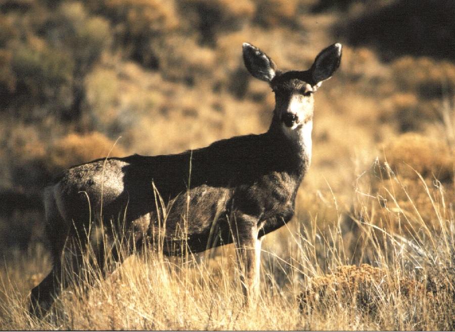
Mule Deer
No, a mule deer is not a cross between a donkey and a deer. Rather, the name is derived from the deer’s characteristic large ears. Mule deer on the Rio Grande usually occupy separate winter and summer ranges. This tour passes through both ranges. The lower areas characterized by mountain mahogany, four-winged salt brush, and rabbit brush provide the necessary nutrients during the winter. While the high country, characterized by open parks, provides summer forage. Mule deer populations are most often limited by the amount of forage available on the winter range. In order to view these beautiful animals, look in the open areas natural or created by logging where the grass is available for the deer.
Elk
Elk, like deer, occupies separate winter and summer ranges. However, elk will move to the high country as soon as the snow melts, while deer might spend the entire summer in the low country. Elk may look like deer to the untrained eye, but they are easily distinguished from deer by their buff rump patch and their larger size. Along the way, notice places where the bark is removed from the bottom of the aspen trees. Those are places the elk spend the winter deriving critical nutrients from the aspen bark. These regal animals are most often seen during the morning or evening hours.
Birds
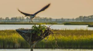
Birders interested in seeing a variety of wildlife will enjoy this tour. The tour passes through low and high country. Common birds in the low country are sage thrashers, Brewer’s sparrows, vesper sparrows, black-billed magpies, vultures, mourning doves, pinyon jays, horned larks, green-tailed towhees, prairie falcons, and an occasional golden eagle. A more unusual occupant sometimes sighted is the Bendire’s thrasher. Once you pass from the low country to the high country, the bird species change along with the vegetation. Common occupants within the high country are Steller’s jays, western tanagers, Williamson’s sapsuckers, warblers, Clark’s nutcrackers, ruby-crowned kinglets, and hermit thrushes.
Coyotes
Coyotes are prevalent throughout the forest despite efforts to limit their populations. Their success is largely due to their variable diet, which includes carrion, rodents, rabbits, insects, game, poultry, and fruit. Coyotes are elusive creatures that are most active in the morning. In order to see them, morning travel is recommended.
Pronghorns
All along English Valley Road, you can anticipate seeing pronghorns. Look for spots of white against the brown background. The white is their white rump patch, while the bodies are a brownish-tan color. Pronghorns are not antelope, but the terms are often used interchangeably. Antelope are found in Africa, while pronghorns are found in the United States. Pronghorns are commonly seen feeding on fortes and grasses in the area, but seem to favor blue grama.
Deer
Mule Deer are seen regularly throughout the Forest but commonly use separate winter and summer ranges. The amount of forage available on winter range often controls deer populations. On this loop, Mule Deer are seen year-round, but traveling in the morning or early evening provides the best viewing.
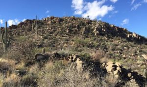
Bighorn Sheep
Sheep are a little more difficult to spot, but if you travel during the right time of day and with a little luck, you might see some on the ledges of Eagle Rock. There is an information sign discussing the sheep at the bottom of the rock. If you scan those ledges above and around the sign, you will probably spot some of these magnificent creatures. The sheep will be a tannish-brown color lighter than that of the rock. During the day, they are difficult to see, but if you tour before 11 a.m., you might see them moving around. Looking for movement will help in spotting the sheep at these times.
Coyotes
An occasional coyote is spotted in this area. If you happen to see one, it will probably be on the move. Coyotes have the ability to cover large areas as well as adapt to varying conditions. This is the reason for their remarkable success despite efforts by man to exterminate them. A coyote looks like a grayish-brown, medium-sized underfed dog. It eats mainly rabbits, hares, and rodents, but also can be seen feeding on carrion, livestock, wild birds, and fruits.
Birds
On English Valley Road the birdwatcher may see horned larks, loggerhead shrikes, vesper sparrows, and Brewer’s sparrows. On the second part on the tour on the turn toward Eagle Rock, potential sightings include mountain bluebirds, bushtits, pinyon jays, Green-tailed towhees, flycatchers, song sparrows, and savannah sparrows. Finally, around the rocky ledges of Eagle Rock, potential sightings include golden eagles, prairie falcons, ravens, rock doves, white-throated swifts, and rock wrens.