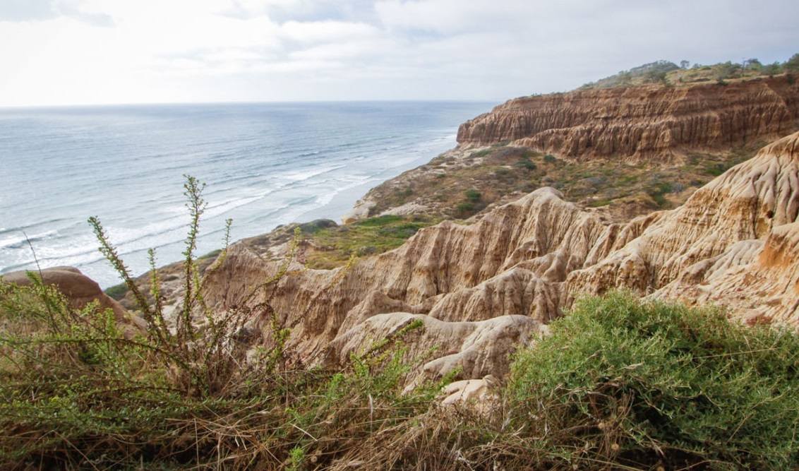
Red Butte, coastal flora and fauna, razor point badlands, coastal views
Near: La Jolla, CA
Distance: 1.3 miles round trip
Elevation Gain: 250 ft
Hike Time: 1 hour
Difficulty: Easy
Trail Condition: Well maintained trail
Hike Type: Out and Back
All of the trails at Torrey Pines are easy, and you can hike them all in half a day if you don’t want to stop and smell the sage. If you go on a weekend, you will have lots of company, and if you go on a weekday, you might have plenty of company as well.
Many people vacation in San Diego; Torrey Pines is famous, and the campus of UCSD is next door. It’s no wonder people come here, there’s beauty, rare trees, pretty wildflowers, coastal views, easy trails, and best of all you are away from the city, while still being very very close to the road and freeway.
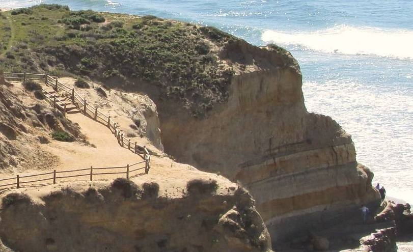
This trail is a beauty, it takes you past Red Butte, you can’t miss it, to the “Badlands” near Razor Point, to a coastal overlook, not bad in less than a mile. You can make this a loop or travel along the same trail back.
Trailhead
The Park is pretty easy to get to – there are numerous ways and they are all signed Torrey Pines State Reserve. Follow the signs to the entrance gate, pay the entry fee and drive to the visitor center. Pedestrian traffic is free.
From the 5 you can take three exits, but an easy way is to take the Genesee exit traveling West toward the ocean. Make a right onto Torrey Pines Road – you will drive past the golf course and when you see the slough and wetlands to your right, you will need to turn left into the Torrey Pines State Beach and Reserve Area. You can park here, but the ranger station is at the top with a very nice visitor center, and lots of trails to explore.
Park at the visitor center, walk to the south end of the parking lot and pick up the trail behind the restrooms. (Lat:32.91791 Lon:-117.25029)