Visitors seeking a unique adventure at Natural Bridges hike the 8.6 mile loop trail over the woods and through the canyons.
Located 35 miles west of Blanding, Utah, Natural Bridges National Monument is managed by the National Park Service. Unlike Arches National Park to the north, this geologic park features stone bridges, not arches.
Though the bridges may be viewed from viewpoints along the monument’s 9.0 mile Bridge View Drive loop, an 8.6 mile long hiking loop leads adventurers to all three bridges, past ancient ruins and rock art, and across a wooded mesa.
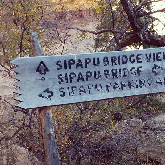
Trails also descend from trailheads along Bridge Drive to their respective bridges, but for hikers wishing to walk the entire loop trail the place to start is at the last bridge: Owachomo. From there, hikers travel 2.0 miles over the mesa top to the Sipapu Bridge trailhead before descending into the canyon. They then proceed from Sipapu to Kachina and on to Owachomo before leaving the canyon and returning to their vehicle.
Mesa Top Trail
From Owachomo Bridge, hikers follow the cairns and signs along the mesa top trail to Sipapu trailhead. The mesa’s pinyon and juniper woodland is where the ancestral Puebloans gathered wood for their dwellings, pinyon seeds for food, and hunted game over 800 years ago.
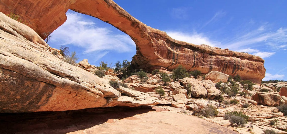
Sipapu Bridge
Named for the Hopi Indian’s spiritual portal where souls pass through, Sipapu Bridge is the second largest natural bridge in the world.
The trail down to Sipapu is 0.6 miles long, but descends over 500 feet. There are metal staircases and wooden ladders at certain spots along the trail. Prior to construction of the staircase, early park visitors had to climb down (or up) a large tree while hiking this trail.
The trail also passes by several granaries where the resident dwellers stored crops. Other granaries are visible across the canyon, tucked away beneath stone ledges. Once at the bridge, hikers continue downstream towards Kachina Bridge.
Horsecollar Ruin, named for the shape of the doorways, is located between the two bridges just above the canyon floor.
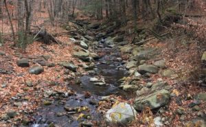
This is a pleasant 2.3 mile hike along the flowing creek of White Canyon and passing through some of the cottonwood galleries that line the stream. During the spring and summer, these trees provide shelter, food and nesting locations for numerous songbirds.
Kachina Bridge
Located 2.3 miles from Sipapu Bridge, this bridge is named after the Kachina figures in Hopi religion. Beneath the bridge’s span are rock art images made by the ancestral Puebloans. The pictographs (painted) and petroglyphs (pecked) images date from over 800 years ago.
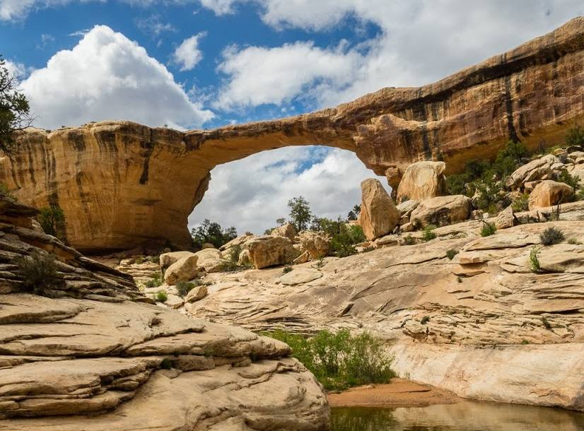
Just below Kachina Bridge is the confluence of White and Armstrong Canyon.
Hikers continue up Armstrong Canyon towards Owachomo Bridge. A rocky pour-off along Armstrong Canyon forms a raging waterfall during flash floods. Shaded during the day, water may remain in this pool throughout the summer, and attracts some different creatures: canyon tree frogs and red-spotted toads.
From Kachina Bridge, the trail up to the canyon rim and parking area is 0.7 miles long and gains 400 feet in elevation. The switchbacks provide ample reasons to stop and admire the view, as well as catch one’s breath.
Trail distance between Kachina and Owachomo is 2.0 miles.
Owachomo Bridge
Located in a side drainage off Armstrong Canyon, Owachomo is the last of the three bridges. Named after the mounds of rock atop the bridge, the National Park Service estimates that this is the oldest of the three bridges.
From the bridge, the trail ascends 0.2 miles up to the parking area.
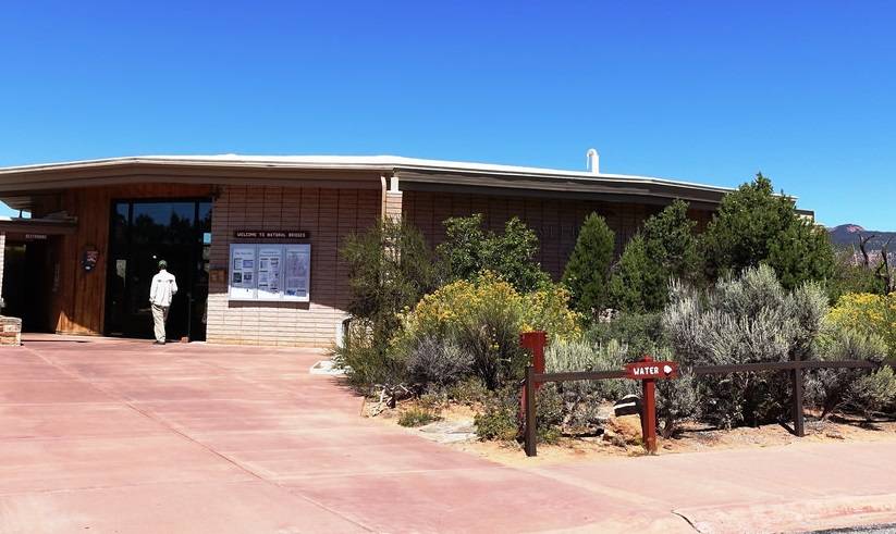
Visitor Center
Located near the monument’s entrance, the visitor center staff provides information about trail and weather conditions. Displays and other interpretive material are available. A very short trail leads from the visitor center to the large solar array field that produces electrical power for the monument’s offices and residential areas.
Though other short trails lead to viewpoints of the stone spans, the 8.6-mile long loop trail in Utah’s Natural Bridges National Monument will lead hikers over the mesa and through the canyons and to the 3 natural bridges: Sipapu, Kachina and Owachomo.