Remote and wild, Misty Fiords National Monument supports many nearly untouched coastal ecosystems and covers about 3,570 square miles (9,246 square kilometers). Several major rivers and hundreds of streams are fed by misty rain and snow each year, as well as by meltwater from glaciers that begin near the Canadian border. Mineral springs and volcanic lava flows add to the unique geological features.
Located in the southernmost part of southeast Alaska, Misty Fiords National Monument extends from Dixon Entrance to beyond the Unuk River. The western boundary is 22 miles east of Ketchikan. It is about 680 air miles from Seattle. The Forest Service manages the area for public use.

Behm Canal, a deep, long waterway of the northeastern Pacific Ocean, leads to the heart of the Monument. Picturesque areas such as Walker Cove and Rudyerd Bay are surrounded by rock walls jutting 3,000 feet (900 meters) above the ocean. Flightseers, boaters, and hikers may photograph, fish, hunt, or view the long, deep, narrow fjords and steep-walled canyons – enjoying the outstanding scenic beauty and rugged terrain of Misty Fiords.
Created on December I, 1978 by presidential proclamation, the Monument encompasses 2,294,343 acres within the Tongass National Forest. In 1980, Congress passed the Alaska National Interest Lands Conservation Act (ANILCA) and designated all but 151,832 acres as Wilderness. Monument status protects ecological, cultural, geological, historical, prehistorical, scientific, and wilderness values. Congress designated the non-wilderness portion to accommodate the development of the Quartz Hill molybdenum deposit. Strict controls on mine development will supposedly minimize the operation’s impact on the surrounding wilderness.
Recreational activities such as camping, hiking, photography, hunting, fishing, boating, continued use of public and private cabins, air access, and outboard motors are all happening within the Monument. Misty Fiords is a major producer of coho, sockeye, pink and chum salmon and king salmon. Numerous other saltwater, freshwater, anadromous fish species and shellfish are plentiful in this area.
Commercial services such as outfitters and guides are allowed, under permit, to provide basic public services in keeping with Monument designations. The Forest Service and the State of Alaska manage fish and wildlife habitat cooperatively.
Ecosystem
The Monument is an unspoiled coastal ecosystem with extraordinary geological features including fiords, steep sea cliffs, active glaciers and natural canals. These features provide rich and fertile marine and freshwater environments. Wildlife, waterfowl, and bird populations are diverse and nearly every ecosystem in Southeast Alaska is represented within Misty Fiords.
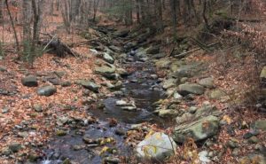
Misty Fiords is known for the number and size of fish found in its lakes and streams. It provides habitat for all five northeastern Pacific species of salmon as well as grayling, Dolly Varden char, and brook, rainbow, steelhead, and cutthroat trout. Nearly half of all king salmon spawning and rearing streams in southeast Alaska are located within Misty Fiords.
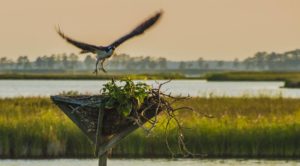
Most wildlife common to southeast Alaska may be found in Misty Fiords. Bald eagles nest in large trees near rivers and shorelines, where pairs share the raising of young during summer.
Alaska’s famous brown bears, black bears, Sitka black-tailed deer, wolves, and mountain goats are the most common large mammals in Misty Fiords. Beaver, mink, marten, wolverine, and river otter are common small animals. In Behm Canal and nearby ocean waters, porpoises, whales, sea lions, and seals are often sighted.
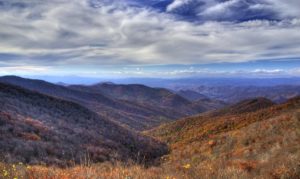
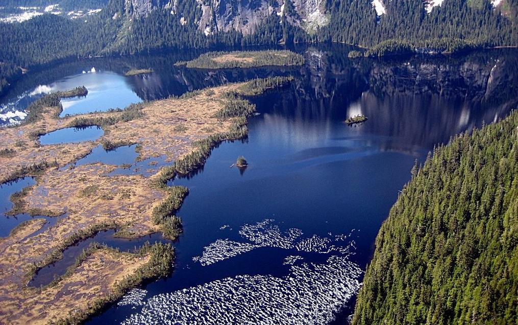
Extending along the Pacific Rim from northern California to Cook Inlet in Alaska is a segment of the coastal temperate rain forest. At first glance, the rugged mountainsides appear to be covered with unbroken conifer forests from the water to timberline. From the air, however, you can see the forest is a mosaic of various densities, subtle colors, and diverse species. Most of the forest consists of old-growth timber stand undisturbed by man.
The forest of Misty Fiords is primarily western hemlock and Sitka spruce, with scattered western red cedar and Alaska cedar. Between forest, stands are openings called muskegs. Muskegs are bog plant communities growing on deep peat and dominated by sphagnum mosses, water-loving plants such as sedges and rushes, and shrubs which adapt to acid soils. Tree growth is sparse within the muskegs and consists mostly of hemlock and lodgepole pine in scrub form. Muskegs provide suitable habitat for many plants, give welcome scenic viewpoints for the foot traveler, help regulate streamflow, and provide homes for wildlife.
Above timberline (generally 2,500 to 3,000 feet in elevation), the alpine zone is dominated by heaths, grasses, and other low plants. Plants such as deer cabbage cover wide areas and provide excellent summer forage for deer. Occasional trees occur, often with stunted or shrublike form due to adverse growing conditions in this zone.
A notable feature of southeast Alaska is the abundance of plant life. Except for steep cliffs, scarcely any area remains devoid of vegetation. Even rock, which is a drier climate would be bare, is soon colonized by mosses, small plants, shrubs, or trees.
Geology
The majestic landscape at Misty Fiords National Monument was created by thousands of years of glaciation and other earth processes. The unique features of Misty Fiords were created by volcanoes, moving snow and ice, and wave action.
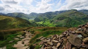
The spectacular hills and mountains of the Monument rise abruptly from a broken shoreline of countless embayments and isolated shoals. Mountain elevations gradually rise to the north, from 2,000 feet in the southern part of Misty Fiords to 7,000 feet along the Canadian border. Many of the steep-walled, U-shaped valleys dissecting the Monument now form the fiords for which the area was named. Several of the fiords are bordered by sheer cliffs plunging several thousand feet to tidewater. In the northeast corner of the Monument, active glaciers (moving masses of snow and ice) reside in upland plateaus and valleys. Meltwater from these glaciers feeds sediment-choked rivers whose channels intertwine into a braided pattern.
Before the onset of glaciation, the hills and mountains of Misty Fiords reached much higher elevations than they do today. The mountains were fairly rugged, but only wind and water eroded them. Streams and rivers flowing through the mountains created V-shaped valleys that would later be deepened and widened by glaciers. The intricate network of waterways, sheer, polished cliffs and sculpted shorelines of Misty Fiords National Monument are striking evidence that massive glaciers carved and molded the pre-existing landscape. The most extensive period of glaciation at Misty Fiords probably took place between about 2 million and 10,000 years ago during the last major ice age, a period of time known as the Pleistocene era.
During this time, periods of cooling accompanied by glacial advances alternated with warmer or interglacial periods. Although average temperatures during glacial periods were only a few degrees colder than today, the change profoundly affected the climate of the earth. Massive accumulations of snow and ice built up, forming valley glaciers and broad ice sheets. These ice sheets, called continental glaciers, repeatedly advanced over North America as massive lobes of ice. At times, these ice lobes extended as far south as the Midwest. Most of the snow and ice forming the ice lobes came from the evaporation of seawater. As the glaciers grew in size, less water was available to maintain the ocean at a constant level.
Consequently, sea level dropped worldwide by as much as 300 feet, exposing large areas along the edges of the continents.
In southeastern Alaska, ice sheets blanketed the exposed continental margins. On the coastal islands, only peaks rising above 3,000 feet stood above the ice sheets and escaped glaciation. Further inland the ice sheets covering Misty Fiords were as much as a mile thick, leaving only the highest alpine ridges and isolated peaks, called nunataks, to rise above the ice blanket.
When the cooling era began, accumulated snow at the head of former stream valleys was buried by new snow and compacted, becoming more granular and dense. With further compaction, it recrystallized into glacial ice.
After many years of snow and ice accumulation, the first alpine and valley glaciers were formed.
As the glaciers began to flow under the force of gravity, they followed the former stream valleys that offered the path of least resistance to the moving ice and began to modify the former stream valleys. The bowl-shaped depressions at the heads of the glacial valleys were enlarged into amphitheater-like basins called cirques. As the glaciers moved down the valley, cracked and jointed pieces of rock were engulfed by the ice and torn or plucked from the underlying bedrock. The eroded rock debris was then drug against the valley walls and floors, gouging grooves and striations into the bedrock. During this process, much of the rock encased in the ice was ground into a fine powder called rock flour.
Much of the crushed rock and silt carried by the glaciers accumulate in elongated mounds, or moraines, which lie along the margins of the glaciers. Lateral moraines are the long, linear stripes of rock debris at the side of the valley walls enclosing the glaciers. When the lateral moraines merge at the confluence of two tributary glaciers a medial moraine is formed. The end or terminus of the active glaciers at Misty are rimmed by a horseshoe-shaped pile of debris called a terminal moraine.
About 10,000 years ago the climate of the earth gradually became warmer and the massive ice sheets which once covered the Monument began to melt and pull back from the coastal lowlands and become increasingly confined to the higher alpine plateaus and valleys. With this worldwide glacial retreat there has been a corresponding rise in sea level. If the world’s glaciers continue to recede, sea level will slowly rise.
Tides
A critical element of the marine ecosystem is the tidal action and freshwater runoff which combine to play an important role in mixing and circulating marine waters close to the shores. The freshwater, being less dense than the saltwater of the Pacific, flows seaward along the surface and gradually mixes with the underlying salt water. This results in layered estuarine environments in the numerous protected bays and passages. Tides occur twice a day and average between 10 and 11 feet with extremes of between 15 and 23 feet. Tides and currents near shore are complex due to the many islands, bays, and passages.
Climate
The maritime climate of southeast Alaska has a great influence on the plants and animals of Misty Fiords. The temperature is moderated by adjacent seas and abundant moisture derived by the air mass lifting over the coastal mountains. Summers are cool and winters moderate, with considerable year-round precipitation, heavy snowfall at higher elevations, and. frequent cloudiness.
During the summers average temperatures vary from 46 to 70 degrees Fahrenheit. Winter temperatures average between 32 and 42 degrees Fahrenheit. Because of the moist air, you can count on rain during your stay in Misty regardless of the time of year you visit. Although the frequency of rain is about the same throughout the Monument, the intensity varies significantly. Yearly precipitation at different sites averages about 160 inches.
Glacial Landforms of Today
The glaciers of Misty Fiords were very effective in transporting the material they eroded, even boulders as large as a small car! After the debris was incorporated into the glacier it was not deposited until the ice melted. Today, we cannot see most of the debris deposited by Misty’s Pleistocene glaciers because it was deposited below the present-day waterline or sea level. However, we can see the glacial landforms that are being deposited today by active glaciers in the northern portion of the Monument.
Good examples of the three types of moraines and an outwash plain can be seen on the Through and Chickamin Glaciers.
Examples of nunataks can be seen north of the Chickamin Glacier. Mount John Jay, Mount Upshur, and other prominent peaks over 6,500 feet high line the International Border, appearing as bare rock islands extending above the surface of the surrounding unnamed glacier.
The largest remnants of the ice sheets in Misty Fiords are along the Canadian border in the area of the Through, Chickamin, and Soule glaciers. The glacial retreat has left the Monument with a rugged landscape. Excellent examples of glacial grooves and striations are preserved on the bare rock faces of the fiord and valley walls. The cliffs known as Owl Cliffs named for their resemblance to an owl’s face, are interesting examples of exfoliation. Large, curved slabs of rock peel or break off due to the release of pressure through uplift, erosion, or the retreat of the massive glaciers.
White Sand Beaches
The retreat of the last continental glacier 10,000 years ago left southeastern Alaska with a highly irregular and unstable coastline. Since then, oceanic processes have continually modified the shoreline and only a few sandy beaches have been established.
Like the white beaches of the Caribbean, these pockets of sand receive their light color from broken seashells. Waves pounding the coastline crush the clamshells in gravel shoals and wash them into embayments along the coastline. Along this portion of coastline, the waves are particularly strong because they come directly from the Pacific Ocean via Dixon Entrance.
Volcanic Actions
Some of the unique features on the north end of the Monument were caused by the interaction of active glaciers and volcanoes. Less than 150 years ago a liquid-like molten rock, called basalt, partially filled two of the U-shaped valleys: the Lava Fork of the Blue River and the Blue River. A volcanic eruption ejected small particles of dark volcanic rock into the air. These particles, called scoria, rained down on surrounding ridges and glaciers and can still be seen today. The basalt lava flowed from the upper Lava Fork river valley to the Unuk River. Trees lining the Blue River valley drowned as the lake formed. Today, only their stumps remain. In the Lava Fork valley, other trees carried along by the flood of lava now lie on their sides, frozen in place within the flow.
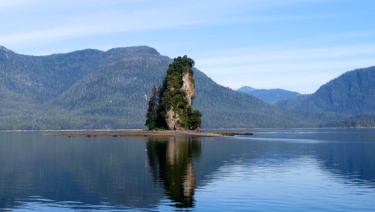
The island called “New Eddystone Rock” is a pillar of basalt. Sometime during the last 5 million years, the basalt came from fractures in the floor of Behm Canal. The broken, haphazard texture of these basalts indicates that New Eddystone Rock was part of a volcanic vent where magma rose repeatedly to the surface of the earth.
When in its molten state, the basalt was very liquid, so that it spread out over a large area, like pancake batter on a griddle. These flows cooled from both the top and the bottom forming the hexagonal columns which are visible on several of the islands surrounding New Eddystone rock. After the basalt flows covered the floor of Behm Canal, another glacial advance scoured away much of the flow, leaving behind New Eddystone Rock and some of the islands to the northeast.
Rock rubble left by the retreating glaciers on several of the New Eddystone Islands consists of large boulders and cobbles which differ in composition from the basalts. Because these boulders and cobbles were not derived from the basalt-covered islands, they are called glacial erratics.
Recreation Cabins
As with other Forest Service areas in Alaska, Misty Fiords National Monument maintains and operates a system of recreation cabins available for public use. Cabins are located in a variety of forest settings, providing users a choice of rustic opportunities ranging from open ocean beaches to high alpine lakes. The twelve cabins located on freshwater lakes usually have a skiff available. The two located on saltwater have mooring buoys nearby. There are an additional six mooring buoys in convenient locations in the Monument.
Recreation cabins are available to the public on a reservation basis for a fee. Reservations may be made up to 180 days in advance, and are booked on a first-come, first-served basis.
Four Adirondack-type (one side open) shelters are available at no charge. They do not require reservations but are available on a first-come, first-served basis. They are located at Manzanita Bay, Nooya Lake, Punchbowl Lake, and Winstanley Lake. The Manzanita Bay shelter is adjacent to saltwater. The others are on freshwater lakes and are accessible by trail from saltwater.
All areas on the Monument are open to camping, but, with the exception of cabins and shelters, campsites are not established. There are no other facilities, so be sure to buy your food and camping supplies before going to Misty Fiords. Ketchikan is the closest city offering a complete selection of supplies.
Cabin reservations may be made by mail or in person at the Forest Service office in Ketchikan.
History
Few marks of human activity are apparent to the casual visitor in Misty Fiords. Evidence of Tlingit and Haida Indian societies and of early American occupation may be found in a few places.
Many of the geographic names of the area originated from Tlingit and Haida native names as well as from early explorers from Russia, Spain, America, and Britain. George Vancouver, the famous British Captain, named many places and special features of Misty Fiords. For example, he put Behm Canal and Eddystone Rock on the map and it is believed that he named Portland Canal after the Duke of Portland. Because he so fully described and mapped Alaska’s coast and this information was published, most of the names remain unchanged today.
A number of southeast Alaska place names recall English civil engineers, structures, and well-known people. Eddystone Reef off the coast of England was a source of inspiration for many of the names Vancouver and others gave to coastal areas in Alaska. Winstanley Island, Smeaton Bay, and Rudyerd Bay were all named for men who had built lighthouses on the treacherous English reef.
The Tlingits who originally inhabited Tongass Island called the island”Kut-tuk-wah.” Following the U.S. purchase of Alaska from Russia, a fort was established on the island. During the summer of 1868, a small tent encampment housing 50 men and 10 officers became Fort Tongass and the first custom house upon entering Alaska.
Access
Misty Fiords National Monument may be reached by floatplane or boat. No permanent roads exist. Ketchikan is the closest city with frequent commercial air service but air charters are also available from Wrangell and Petersburg. Those not familiar with boating conditions in southeast Alaska should be cautious about taking their own boat through the unpredictable waters of Behm Canal in Misty Fiords. Storms can come up quickly, causing serious risks for those without knowledge of the area or who are not properly equipped. Flying time from Ketchikan to Rudyerd Bay is about 30 minutes; boating distance is about 50 miles.