There are three designated Recreation Areas in Los Padres National Forest: Figueroa Mountain, Sage Hill, and Santa Ynez. Each area offers a diverse variety of recreation opportunities, largely oriented for family and group outings.
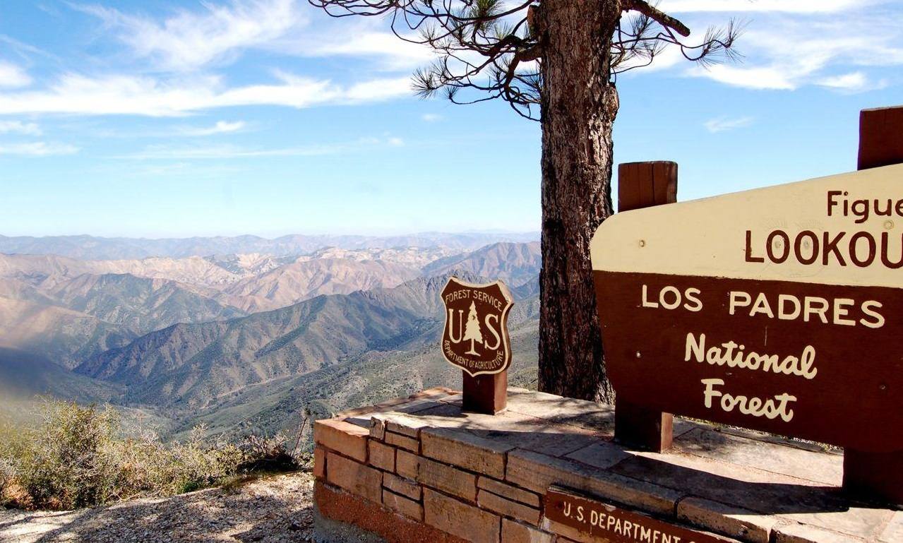
Figueroa Mountain Recreation Area
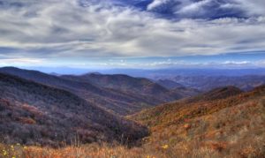
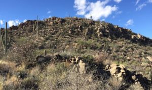
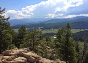
The Figueroa Mountain recreation area lies thirty minutes north of Los Olivos and can be reached by the Figueroa Mountain Road or the Happy Canyon Road. Both roads are paved, but Happy Canyon Road is not recommended for trailers. Happy Canyon Road occasionally is closed in the winter due to earth slides. Most of this recreation area is covered by heavy chaparral. Large Big Cone Fir, Ponderosa Pine, and Jeffery Pine occur at the higher elevations on Figueroa and Ranger Peaks. Blue Oak and impressive Digger Pine occur throughout the lower elevations. Fir Canyon, Davy Brown and Manzana Creeks all have water and the attractions associated with lush vegetation and diverse wildlife. The Figueroa area is a fascinating place where recreation opportunities vary with the seasons.
Winter months can find occasional snow during January and February when winter storms sweep through. The snow seldom lasts for more than a few days except on shaded slopes in the pines where it tends to last a while longer. The Figueroa Mountain and Zaca Ridge Roads are frequently closed to vehicle use during rain periods to protect the dirt roads.
Springtime on Figueroa is a season of fantastic flower displays. Late March brings out the early blooming specimens such as purple shooting stars and filaree. Later arrivals on the mountain include blue lupines, chocolate lilies, golden poppies, and the scarlet Indian paintbrush. Fishing occurs from March to mid-May in Davy Brown Creek below Davy Brown Campground and in Manzana Creek. The State Dept. of Fish and Game annually stocks catchable size trout in the streams after the high water runoff. By early May the fish stocking is discontinued when water levels decrease and water temperatures rise.
Summertime in the Figueroa area finds many visitors seeking the cool shelter of tall pines and fir at the higher elevations. The cool waters of Davy Brown Creek and Manzana Creek are attractive to young and old alike, seeking relief from the hot summer sun. Small gnats can be a nuisance at times so bring your insect repellent.
Fall months, September-November, frequently have some of the most pleasant weather and fewest visitors of the year. The fall Indian Summers is a favorite time to camp in tranquility, especially mid-week at any of the sites.
Picnic Areas
There are four picnic areas on Figueroa Mountain which are open 6:00 a.m. to 10:00 p.m. daily, they are: 1) Cumbre located among the pines high on Figueroa Mountain: 2) Catway on the Catway Road overlooking the Santa Ynez Valley; 3) Figueroa Lookout site is situated atop Figueroa Mountain adjacent to the lookout and offers a panoramic view of the San Rafael Wilderness; 4) Pino Alto picnic area is among the pine and fir atop Figueroa and will accommodate the handicapped. This picnic area includes a paved interpretive trail suitable for wheelchair use, one-half mile of easy going and 30 to 45 minutes to traverse.
Camping
There are five family campgrounds in the Figueroa Mountain area that you can drive to and one trail camp:
Figueroa with 32 sites and water available. This is a no charge campground set in a stand of pine and large Manzanita. It is open all year and offers a good view of the valley. At night you can see the lights of Santa Ynez and the glow of Santa Barbara in the distance. The campground is close to a number of hiking trails.
Davy Brown with 13 sites, water available. This is a no charge campground and is open all year. Davy Brown is close to a number of hiking trails and an adjacent creek flows throughout the summer.
Nira with 12 sites, drinking water must be brought in or obtained at Davy Brown Campground. There is no charge for camping here. Manzana Creek flows beside the campground and is a popular attraction although it gets low in the summer. Nira is at the end of the road and the starting point for backpackers and equestrians visiting the San Rafael Wilderness, where the only ways to travel are by foot or horseback.
Cachuma with six units is located on Happy Canyon Road. There is no charge for camping here. Cachuma is set among large oaks in a narrow, shaded, canyon.
Ballard trail camp is accessible only by foot or horseback and contains two units. Water is available at a nearby spring.
Sage Hill Group Recreation Area
Sage Hill Group Recreation Area is planned exclusively for group camping. It has been designed to accommodate moderately sized groups for both day-use and overnight camping. The area is available by reservation throughout the year, including holiday weekends.
Facilities
The recreation area consists of five separate loops. Each loop contains a centralized cooking and eating area, flush toilets, water faucets, and numbered parking spurs. All loops have a group barbecue pit, a service table, four picnic tables, and a fire pit. Loop 5 contains corrals for equestrian use. There are no trailer hookups or dumping facilities. Loops 1 and 2 do not have any shade trees, although they have saplings that will provide shade in the future. Loops 3, 4 and 5 are situated in an established oak grove with plenty of shade.
Group size
The minimum size allowed for reservations is 25 people. Each loop is designed to accommodate 50 people comfortably. The maximum number that can be seated at the picnic tables is 56. Larger groups can reserve more than one loop. Loops 3 and 4 are designed for this purpose.
Fire Use
Open fires are permitted only in established firepits and barbecues within the campground.
Winter Use
The Sage Hill area may be closed due to high water in the Santa Ynez River after heavy rains between November and March. The campground will be evacuated during severe rain and flooding conditions. Please contact the Los Prietos office for up-to-date river conditions several days before your arrival.
Recreation
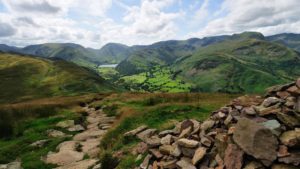
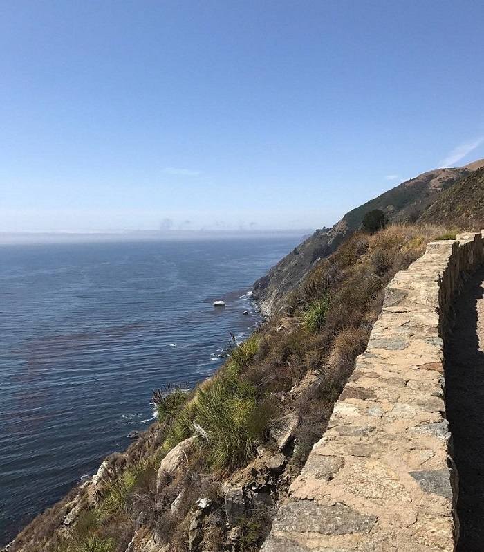
The Sage Hill Group Area is set on the Santa Ynez River, which is the longest stretch of free-flowing river accessible to the public in Southern California. Fishing, mountain bicycling, hiking, and horseback riding are popular activities in the Canyon. All of the trails in the canyon are used by hikers, mountain bicyclists, and equestrians. When you encounter stock on the trails, stop and stand quietly to the side until they have passed.
Aliso Canyon Nature Trail: To learn more about the natural history of the area, you may want to take the Aliso Canyon Trail. This trail begins at the north end of Loop 5. It follows Aliso Creek, then climbs to the top of the ridge. You can continue 1.5 miles to Upper Oslo Campground or follow the 3-mile loop and return to Sage Hill. The trail is steep in places, but the climb offers wonderful views. Self-guided brochures are available at the trailhead or at the Ranger Station.
Santa Ynez Recreation Area
Welcome to the Santa Ynez Recreation Area on the Santa Barbara Ranger District of the Los Padres National Forest. The Santa Ynez River is the longest stretch of free-flowing river in Southern California, and the recreation facilities in Santa Ynez Canyon provide a good place to enjoy the river.
Recreational Opportunities
Aliso Canyon Nature Trail: For those interested in learning more about the natural history of the area, this self-guided trail provides a good introduction. The trail begins behind Sage Hill Campground. It follows Aliso Creek, then climbs to the top of the ridge, making a 3 mile loop. It is steep in places, but the climb offers wonderful views. Self-guided brochures are available at the trailhead or at Los Prietos Ranger Station.
Picnicking: If you want to picnic next to the river, you can choose from four areas in the canyon especially designed for this: White Rock, Lower Oso, Falls and Live Oak. All have tables, barbecues, and toilets. These are open 6:00 a.m. to 8:00 p.m. daily. A concessionaire’s fee is charged for their use.
Fishing: During the spring months, the Santa Ynez River is stocked with trout and the fishing is usually quite good. A State Fishing License is required. For information about fishing opportunities in Gibraltar Reservoir contact the City of Santa Barbara.
Horseback Riding: All of the trails out of the canyon are open to equestrians, and two campgrounds are equipped for horses. Upper Oso has 14 corrals and extra long parking spurs. One loop in the group camp, Sage Hill, has hitching posts and 12 corrals. Riding trails lead out of both sites. Gate closures are in effect in some backcountry areas. Call ahead for information regarding your route.
Off-Highway Vehicles: There are two off-highway routes for two-wheeled vehicles and ATV’s accessed from the Canyon: Camuesa and Buckhorn roads. Both are well-maintained fire access roads, suitable for beginning riders. Camuesa road is 16 miles long, beginning at Upper Oso Campground. Buckhorn Road forks off Camuesa road 4 miles up and is 9 miles long. These routes are for two-wheeled vehicles and ATV’s only. More information about additional OHV routes can be obtained from the Ranger Station.
Camping
There are 4 family campgrounds in the Canyon. All have paved roads, piped water, barbecues, fire pits, tables, trash bins, and toilets. Some have extra-long parking spurs suitable for trailers, but none have hookups.
Hiking
There are many good trails leading out of the canyon. Just a few are listed below. Ask at the Ranger Station about others. All of the trails in the canyon are used by both hikers and equestrians. When encountering stock on a trail, stop and stand quietly to the side until they have passed.
Snyder Trail is a nice day hike. It goes 6 miles up to East Camino Cielo. Just below the top, take the trail west to Wellhouse Falls. The trailhead is 1/4 mile west of the Los Prietos Ranger Station.
Matias Potrero Trail continues 2 miles up to Matais Potrero Camp and a small spring. The trail begins 2.5 miles east of the Ranger Station.
The Santa Cruz Trail is one of the most popular trails. It goes 1.5 miles to Nineteen Oaks Camp, then 4 more to the top of Little Pine Mountain. If you continue on this trail, you can enter the San Rafael Wilderness. The trailhead is at Upper Oso Campground.
Another good place to hike is on either of the roads that lead to Gibraltar Reservoir. These begin in the parking lot at the back of the canyon where Paradise Road ends, and are closed to vehicular traffic. The Reservoir is part of the water supply for Santa Barbara, so bodily contact with the water is forbidden.
Canyon Regulations
- Access to the Canyon, as well as general access to the river, and most picnic areas are open from 6:00 a.m. to 8:00 p.m. daily.
- Pets are welcome as long as you keep them under control. Generally, this means keeping them on a leash. They must be kept on leashes whenever they are in campgrounds or picnic areas.
- Campfires, barbecues, and fuel stoves are allowed only in provided facilities at designated sites within the established day-use areas and campgrounds.
- Camping is permitted only in campgrounds.
- Shooting or hunting are not allowed in the Recreation Area.